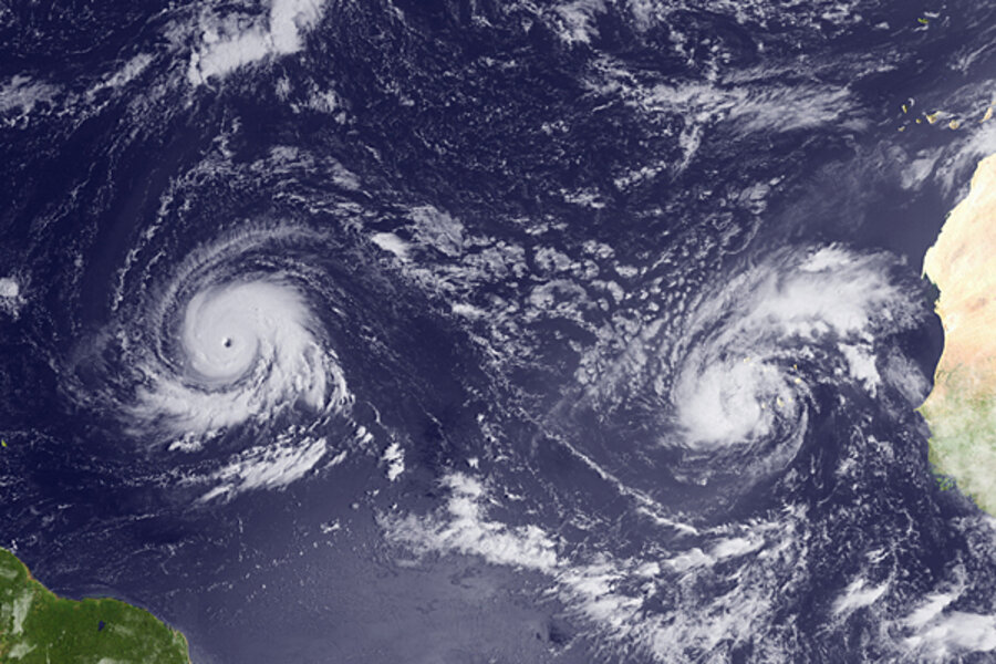
National Hurricane Center: Hurricane Igor intensifies quickly
Loading...
Fed by unusually warm seawater and protected by favorable wind conditions, hurricane Igor has quickly become one of the 2010 Atlantic season's most powerful storms.
The hurricane, currently about 900 miles east of the Leeward Islands, is likely to undergo some short-term intensity shifts over the next two days, forecasters say. It could flirt with Category 5 status, the most powerful class of hurricanes.
If it reaches that level, it will be the first Category 5 Atlantic storm since 2007, when hurricanes Dean and Felix clocked maximum sustained wind speeds of 175 miles an hour. Dean made landfall as a Category 5 storm at Costa Maya, Mexico, on Aug. 21. Felix struck Punta Gorda, Nicaragua, about two weeks later.
Igor, by contrast, is churning along a course in the Atlantic that is expected to keep it well out to sea, although by Saturday the storm is forecast to reach a spot about 200 miles southeast of Bermuda. Its hurricane-force winds extend up to 40 miles from the center, with tropical-storm force winds extending to up to 175 miles from the center.
Igor's intensification came quickly. An early-morning advisory from the National Hurricane Center in Miami on Sept. 12 put the storm's maximum sustained winds at 80 miles an hour. By 2:30 p.m. Eastern time on Sunday, Igor's maximum sustained winds hit 135 miles an hour, pushing it into Category 4 status. The storm currently has maximum sustained winds near 150 miles an hour and has become the third "major" tropical cyclone of the season – a tag given to any tropical cyclone whose maximum sustained winds top 110 miles an hour.
Igor got its kick as it encountered a perfect environment, says Dennis Feltgen, spokesman for the National Hurricane Center.
Hurricanes draw their energy from warm sea-surface temperatures, and those temperatures in the Atlantic's main hurricane-forming region are at record levels, Mr. Feltgen says.
And the atmosphere displayed virtually no vertical shear – a major change in large-scale wind speed or direction with altitude. Too much shear stymies a storm's ability to organize or to hold itself together once organized.
For that, Igor can thank La Niña, one-half of the El Niño-Southern Oscillation cycle in the tropical Pacific whose direct and indirect effects on atmospheric circulation patterns appear in many regions around the globe. One effect is to reduce the frequency and intensity of wind shear in the tropical Atlantic.
According to the National Oceanic and Atmospheric Administration's Climate Prediction Center, La Niña is strengthening and is expected to last through the Northern Hemisphere's winter.
Forecasters also are watching tropical storm Julia, which formed Sunday from a tropical depression off Africa's west coast. The southern Cape Verde Islands have been under a tropical-storm warning since Sunday morning.


