Hurricane Irene hurtles toward North Carolina, may skirt Florida (VIDEO)
Loading...
As hurricane Irene leaves the Caribbean island of Hispaniola and begins a projected path that puts landfall on the North Carolina coast Saturday, top emergency management officials are urging residents all along the US East Coast to make preparations now.
"We've got a lot of time for people to get ready, but we don't have forever," said Craig Fugate, who heads the Federal Emergency Management Agency, during a briefing Tuesday.
Unlike Earl, a major hurricane in late August 2010 that flirted with much of the US East Coast but didn't make landfall until it reached Nova Scotia, Irene is projected to make landfall near Morehead City, N.C., Saturday.
The current track forecast takes the storm inland up the North Carolina and Virginia coasts and onto the Delmarva Peninsula Sunday morning.
Federal forecasters monitoring Irene caution that the accuracy of their track forecasts can be off by as much as 250 miles five days out. Even so, "a little deviation in the track" can have a significant impact on the storm's effect on the coast, Mr. Fugate cautions.
The storm already is large for a hurricane, with hurricane-force winds extending some 50 miles from the center and tropical-storm-force winds reaching out as far as 205 miles from the core.
"It's a large storm to begin with," says Bill Read, director of the National Oceanic and Atmospheric Administration's National Hurricane Center in Miami. "As these storms move northward into the mid-latitudes, they grow as a matter of natural course. So we're going to have a very large tropical cyclone move up the eastern seaboard over the next five to seven days."
A land-falling Irene would mark the first direct hit from a hurricane since 2008. That year, Ike struck the Texas coast at Galveston Island as a Category 2 storm and drove deep into the continent as a tropical-storm-force storm. Ike caused an estimated $29.5 billion in property damage, second only to hurricane Katrina's $108 billion in damage.
Emergency managers in North Carolina told the Associated Press that they have been taking stock of generators, fork lifts, and other supplies in anticipation of Irene's arrival. In addition, FEMA teams in the state are stepping up their contacts with North Carolina emergency managers to help with evacuation plans and other preparedness measures.
Irene's projected track up the Southeast coast has slowly migrated east over the past two days, taking the storm farther away from Florida than previous forecasts had indicated.
Still, emergency management officials are asking Florida residents to stock up on supplies to be ready.
"We must prepare for the worst and hope for the best," said Joe Martinez, chairman of the Miami-Dade County Commission, in an interview with the Associated Press.
Before Irene makes landfall, current projections indicate it could strengthen to Category 3 status, with sustained maximum winds of 125 miles per hour before reaching the coast.
But concerns about Irene's impact extend to the mid-Atlantic and Northeastern states, as well. At this stage, forecasters say, it's too early to know if Irene will remain a hurricane if it makes landfall at the currently projected location. If the track continues to veer to the east and the storm remains over water, the likelihood increases that Irene would retain hurricane strength as it moves quickly up the coast.
Dr. Read notes that the mid-Atlantic and Northeast have experienced repeated storms bringing heavy rains this summer. The ground in many places already is saturated. Even if Irene weakens and hits the Northeast as a tropical storm or something weaker, high winds and heavy rain could bring flash floods and widespread power outages as winds down trees whose roots already have lost some of the grip in saturated soils.
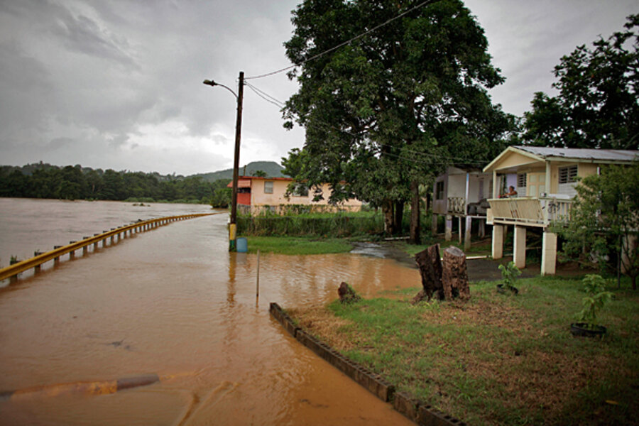
On Monday, President Obama issued an emergency declaration for Puerto Rico, which is coping with the aftermath of Irene, including power failures affecting more than 1 million people.
[ Video is no longer available. ]


